As well as national and provincial parks offering many camping and outdoor activities, we are fortunate to have such offerings at conservation areas around the province. One we had an opportunity to visit this year was the Rockwood Conservation Area at Rockwood, Ont.
This falls under the jurisdiction of the Grand River Conservation Authority, which maintains another 11 sites throughout that watershed.
Rockwood has 46 serviced campsites (electricity and water), 16 full service (water, hydro and septic) and 43 unserviced sites. An online camping reservation system can be used to book a site. We accessed the park travelling north on the Guelph Line, and turning east on Hwy 7 toward the town of Rockwood, which is adjacent to the park itself.
The primary reason for staying here was to be able to visit an equestrian show our granddaughter was competing in at the Angelstone Equestrian Centre in nearby Erin, Ont. We did, however, want to do some hiking at the area. The Eramosa River flows through this conservation area and a reservoir created offers swimming, fishing, canoeing and kayaking activities. In the Rockwood reservoir you can paddle around small islands, past towering cliffs and through narrow channels. It is quite scenic.
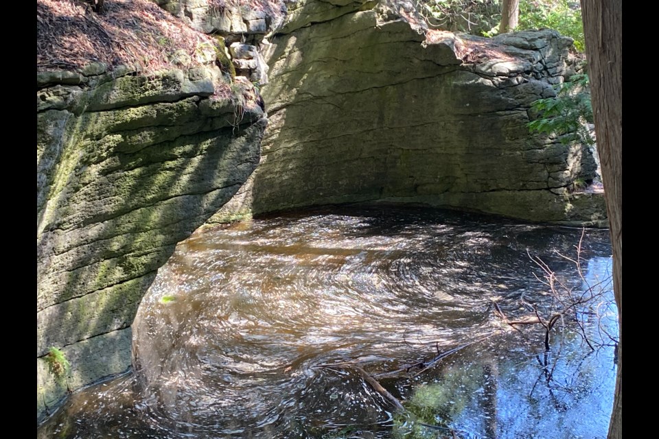
The location of the conservation area along the Niagara Escarpment offers some unique sights along the two hiking trails. Top on my list to see were the large numbers of geological features called glacial potholes. These are rock creations made during periods of glacial melting, when very high water flow caused harder rocks to spin in a confined area and wear down the limestone rock underneath.
I had become aware of potholes elsewhere on the escarpment, but was amazed to discover the quantity (more than 200) and size of the ones located at Rockwood. A well-maintained trail and boardwalk takes you through this area.
An interesting historical site to see is the remains of the Harris Woollen Mill Ruins. This substantial structure is located at the end of the hiking area. It is currently fenced off for security and safety, but quite visible.
The mill was founded by John Richard Harris in 1867. The stone building (now the ruins) was built in 1884 to replace the original wooden building which was lost to fire. The Harris family continued its operation until 1925, before they closed it down due to competition from other mills. The conservation authority acquired it in 1958 but another fire in 1967 reduced it to the current state.
Further on, across a bridge, we followed a lane to the other geological feature that is an attraction in the area — huge caves. The two that we examined were quite deep and interesting to view. Care should be taken and deeper probes of these areas require planning.
This is an interesting area for a few days of camping or for a day visit. The unique sights to explore and other outdoor activities to be enjoyed and make it on a to-do list.


